













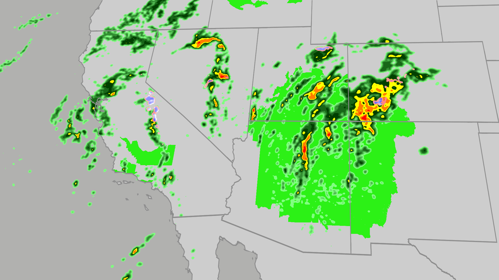
Flood risk, severe storms threat from California to Colorado
Large hail, tornadoes, flooding possible on Wednesday for Southwest
Tropical moisture and favorable atmospheric conditions are fueling a flood risk this week across seven states from California to Colorado. Severe storms are also likely, especially across Arizona.
Millions are under a flood watch as days of rain bring a threat of debris flows and landslides, especially across burn scars.
Happening now
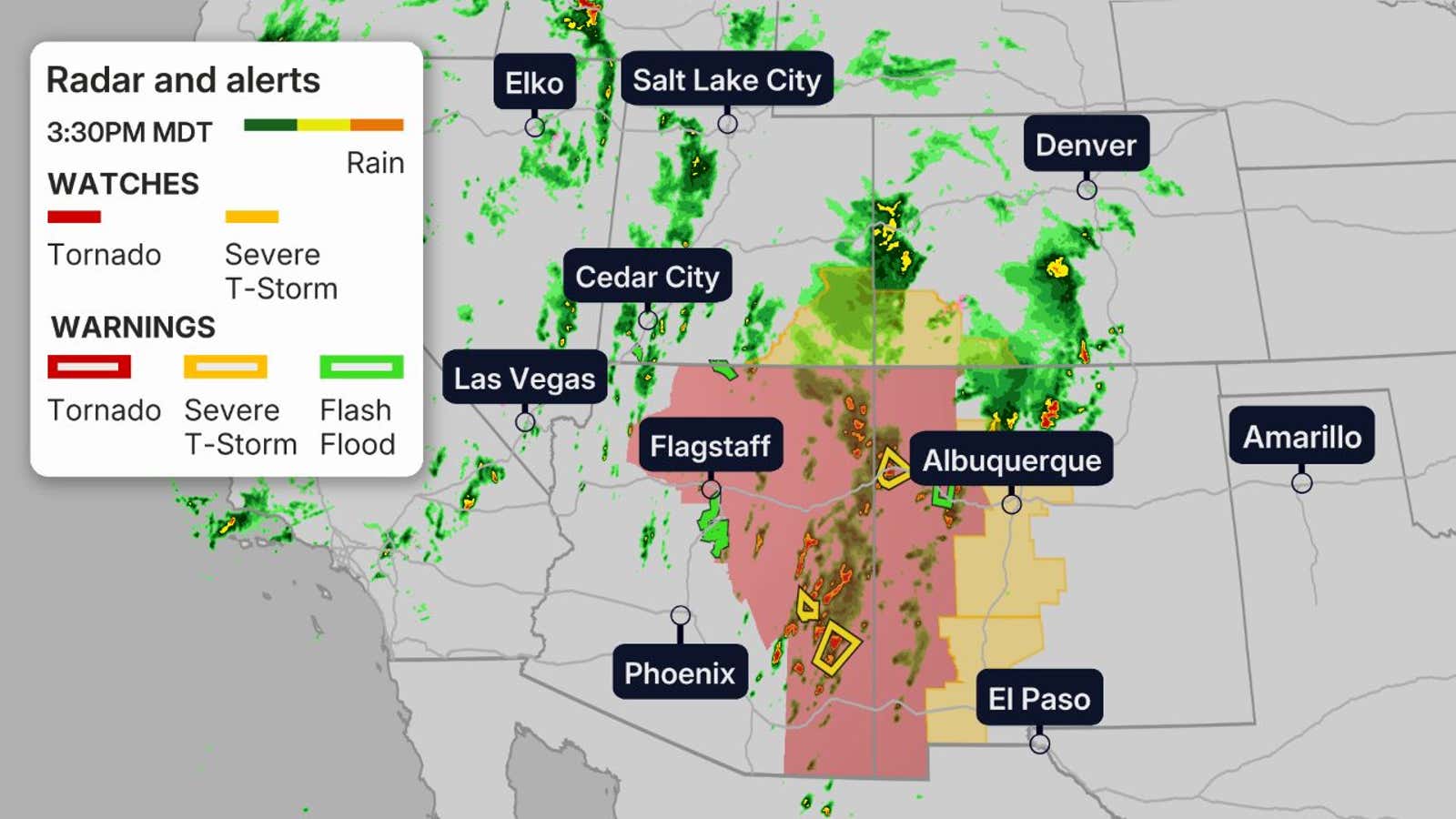
Severe storms and bands of heavy rainfall are hitting parts of California and the Four Corners region.
Any ongoing tornado watches and warnings as well as any flash flood warnings are on the map below:
Flood threat
Moisture will continue to pump into the Southwest on Thursday, only enhancing the flood threat on already saturated soils.
Some forecast models are alluding to near record levels of moisture available for October in this region, which means there’s a great concern for flooding and the possibility that rainfall amounts could end up higher than currently forecast.
Get More of Our News on Google
Set The Weather Company as a ‘Preferred Source’ to get quicker access to the news you value.

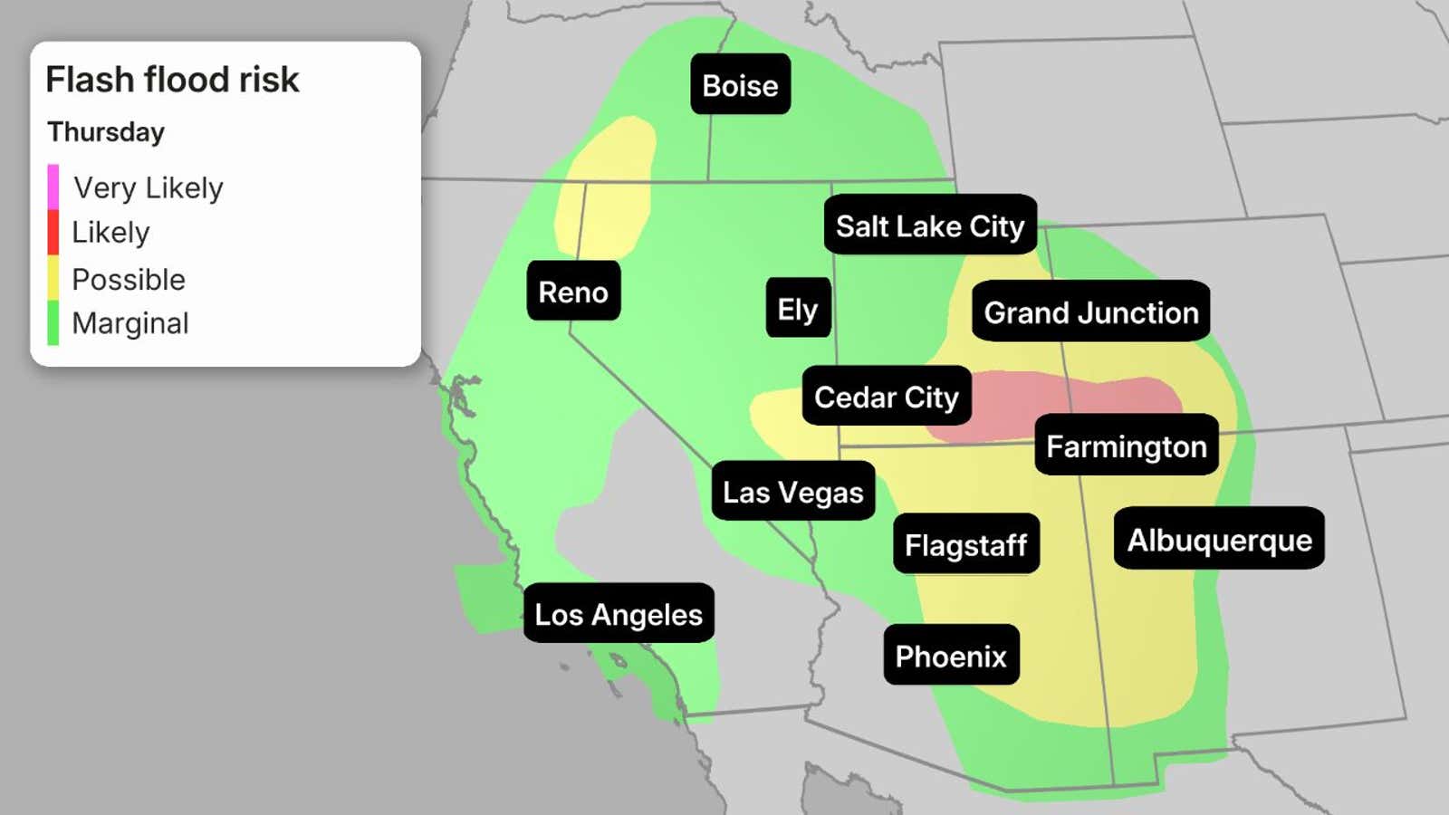
While the greatest risk for flooding remains for much of Arizona, Nevada, New Mexico, Colorado and Utah. This includes places like Las Vegas, Phoenix, Tucson and Albuquerque.
Some of the biggest concerns will be the possibility of mudslides over recent burn scar areas as well as slot canyons and arroyos.
If you have plans to visit any of the national parks in the West this week, make sure you check the forecast daily and pay attention to any warnings or advisories issued.
Severe threat
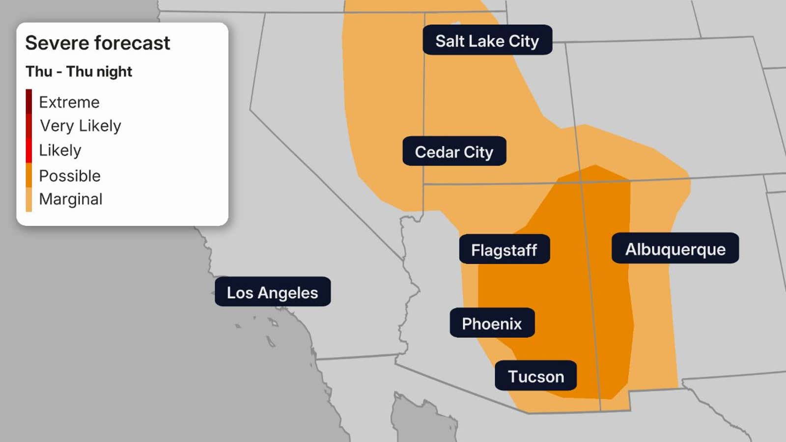
There is also an enhanced threat of severe weather on Thursday.
Isolated storms could produce strong wind, hail and even a tornado across portions of the Desert Southwest and Four Corners region, with Arizona under the greatest risk yet again.
How much rain and snow is expected?
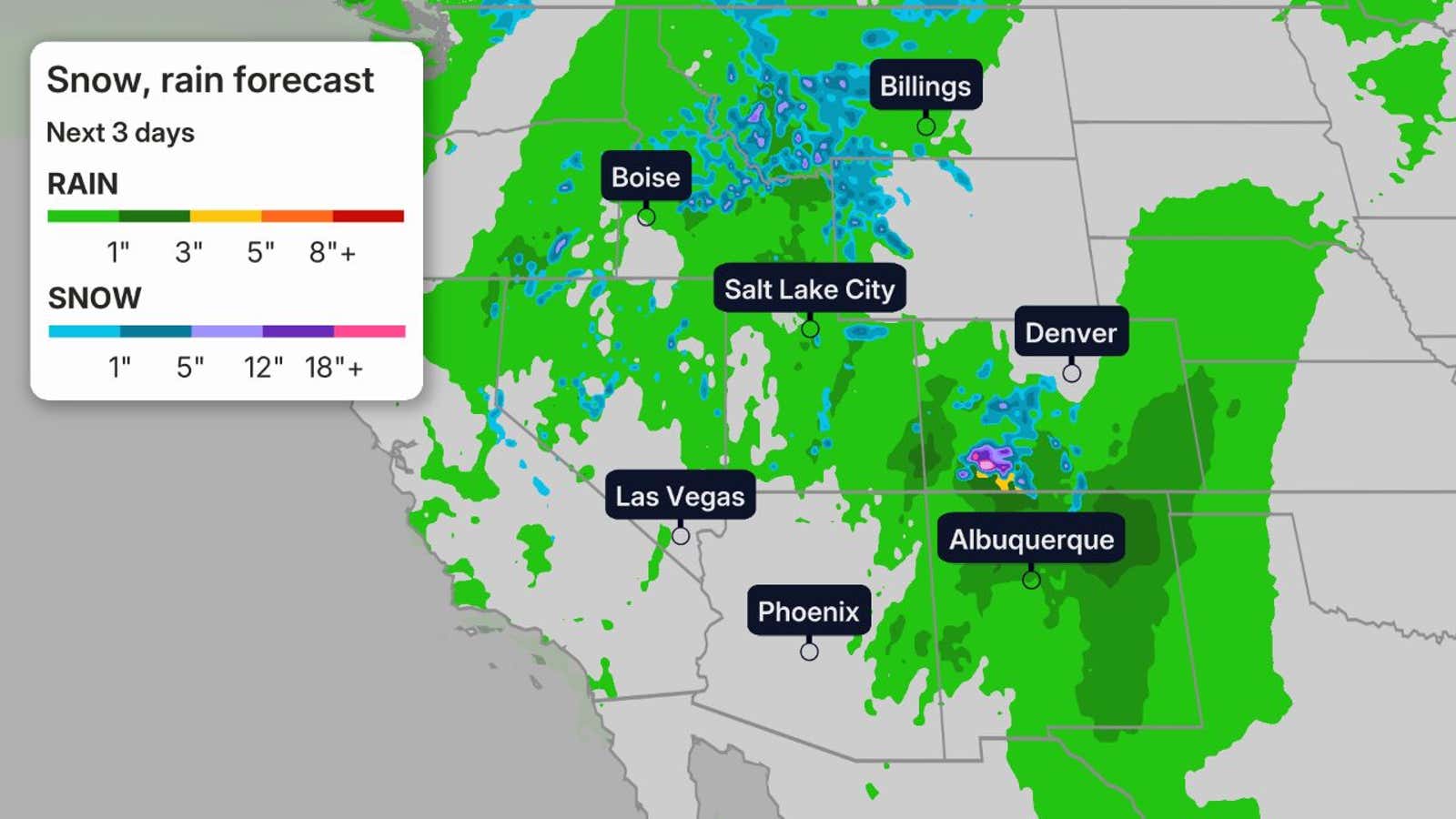
As much as 3 inches of rain is expected across portions of the Desert Southwest, which is more than enough for flash flooding in this region. Some isolated locations could see up to 5 inches.
And yes, we could even squeeze some snow out of this system for some of the higher elevations.
Parts of the Sierra and Rockies could see the first significant snow of the season. This could be a nice base for some of the ski resorts that were robbed of snow last winter.
While widespread snowfall totals will stay under 6 inches, we could see isolated peaks pick up a foot of snow.
Make sure you check back often, as the forecast could change. And don’t be caught off-guard if you are traveling through some of the higher elevations, as the rain could change to snow quickly.
Recap
Downtown Flagstaff reported hail the size of golfballs, or 1.75 inches in diameter, on Wednesday. There was also a gust to 72 mph at the Flagstaff Airport.
The first tornado watch was issued for northern Arizona in more than 16 years on Wednesday.











Post Comment